Walking Holidays Liguria
Walking Holidays Exploring the
Land of Colours
With Lorenzo
The Old Bridge Trail Santa Brigida
Distance: approx 6 km | Time: 2 - 2.5 hours | Difficulty: easy | Height gain: 275 m
An easy and charming circular walk starting at 450 m above sea level amongst chestnut and oak trees with the backdrop of the Mediterranean. It begins at the chapel of St.Brigida dating back to 1425. Well signposted. It descends rapidly in the rio Merea valley. When we arrive close to a modern dwelling we immerse ourselves into the thick woodland and follow an old pathway which will lead, after a very pleasant walk, to the first of the old stone bridges built in the early 800 hundreds. From here looking down on the far left on the river bed we will see an old stone dwelling once used by a hermit called pre' Luigi. It has been often said that he was able to see into the future and would talk of flying men and carriages without horses. Nearby you will admire relaxing rockpools and a lovely little waterfall.
The trail then starts a gentle rise and we will come across the typical old stone "caselle" these are often rectangular drystone dwellings used in the past by the shepherds for shelter and are found in this part of Liguria only, in the interior up to an altitude of approx a 1000m. We then descend on the left towards the valley and we come across the the cultivation of lavender, once very diffused in this area. We then come to the second stone bridge, this one older than the first and called Ponte Martelli, once used to connect the two villages of Dolcedo and Pietrabruna. Soon after the bridge the trail gets quite steep and we walk through the old olive groves which are so typical of this area. We will come across the "Casa", an old building now in ruins that was used by the shepherds to shelter the sheep. From here we follow the signs which will lead us back to the old chapel.
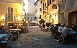
Note: this pleasant walk can be finished by an interesting visit to the old charming village of Dolcedo on the opposite valley famous for it's old bridges and fascinating medieval streets, here we can take a pleasant refreshment by one of the many delightful café bars.
The Small Athens Amongst the Olive Trees
Distance: 8 km | Time: 4 - 5 hours | Difficulty: Medium hike | Height gain: 400 m
Villa Faraldi is known as the small Athens because of it's well established and renowned Theatre festival held every July.The village has a small colony of International artists encouraged here by the arts.
Lovely extracts from poems hang on slate frames throughout the old alley ways. This mid mountain hike starts at the top of the village were we quickly gain height and leave behind the olive trees. The tiny chapel of St.Bernardo will greet us on the way and we will carry on north towards Pizzo Aguzzo. After consistent steep walk with breathtaking views all around, including the blue sea, we will arrive at the high point that separates the two valleys: one gentle towards the sea and the other steep. When we reach Pizzo Aguzzo (sharp peak), we can decide depending on the group and weather conditions: to carry on towards Pizzo Evigno, the highest point in the immediate area at over 1000 m (superb views); or to retrace our way back towards the small hamlet of Tovo. As we descend we will notice the predominance of the roverella which is the small Mediterranean oak. Another small rural chapel by the name of St.Sebastiano will be on our itinerary towards Tovo which is very characteristic for it's assembling of old buildings along the edge of the hilly crest. Here the old Roman fountain can be viewed. A brief walk on the secondary road will take us back to our starting point in Villa Faraldi were we can relax at one of the many charming trattorias.


The Orchid Paradise trail
Distance: 7 km approx| Time: 2.5 - 3 hours | Difficulty: easy-moderate | Height gain: 350m
This circular scenic walk circumnavigates the beautiful and most preserved medieval hamlet of Cervo (officially classified as one of the most beautiful in Italy). We will walk through different vegetation environment that constitute the "Mediterranean macchia". The walk starts in the square at the top of Cervo by the old Feudal Castle and descends down a footpath towards the sea and the famous beach of "Porte ghetto". At the bottom a sharp turn to the left will take us on the historic old Roman road, a remnant of this ancient route that conducted to Gaulle. Another sharp left leaves the road and climbs steeply amongst olive trees - an abandoned land which is being recolonized by spontaneous vegetation such as the maritime broom and the Aleppo pine. We then enter the small country park of Ciapa, with thick woodland of Maritime Pine. We keep on the right and reach the promontory that separates Cervo from Andora. Here the view is truly stunning of the sea below and on very clear days, which is often, you can admire the Tuscan coastline. We take a sharp left and arrive on the "colle of Castellareto" which is the first nucleus of the local inhabitants even before the Romans. We keep walking through lovely countryside and it is here that in Spring, the flowers of rare wild orchids can be spotted in the grassland. We walk past the masts on top of the hill and take the sharp road heading south in thick woodland. Eventually the olive groves recolonize the land and we eventually come past some ruins from which the old chapel of San Giuseppe stands proud. Here we leave trail marked 1 and we take no 21 where further down we cross an old bridge and through olive terraces we reach the old square - Cervo. A visit to this medieval village is a must with it's impressive church of St.John the Baptist, beautiful historic palaces, a small museum of the olive oil, and of course lovely trattorias and bars perched high up with fantastic vistas over the sea below.
Le Cinque Terre (The 5 Lands Trail)
Distance: 13.5 km | Time: 5 hours + | Difficulty: Moderate | Height gain: 220 m
This area of Liguria is by excellence one of the best in Italy for it's wonderful walks and not surprisingly very popular. In this area we have a wonderful choice of coastal and high level routes depending on the requirement of the party and almost anything can be customized to suit accordingly.
We begin with the classic "Sentiero Azzurro" or blue trail since it follows all along the sea from Riomaggiore, the first of the famous villages perched on the clifftops above the sea, to the fifth and last called Monterosso (hence the 5 lands). We begin in Riomaggiore in the quaint station square and walk on to the lovers trail (couples beware: many here have asked for marriage vows overwhelmed by the beauty of the landscape and the blue sea below) we walk it's entirety with the stunning views around. We then reach Manarola and cross through the pretty centre towards the direction of the cemetery
This walk is an absolute must for coastal path lovers and ideal if arriving to Genoa Airport where we will arrange to pick you up and drive the short distance away where we can stay in one of the local pensiones (bed and breakfast) on the coast. A wonderful way to start your exciting holiday in Liguria. Trips to the elegant resorts of world famous Portofino and S. Margherita Ligure nearby can of course be arranged at your request, with equally stunning walks in the regional Natural Park of Monte Portofino, to reach the stunning location of S.Fruttuoso. where we start a steep section and then level out for a nice walk to Corniglia amongst the scent of the local Mediterranean herbs.We descend on a series of long sections of steps to the village where a drink or ice cream is most welcome and then we carry on to Vernazza on a series of lovely bridges and stunning scenery. Here begins the most involved part of the route and the steepest, where care must be exercised on some of the narrow paths. We eventually reach Monterosso crossing through cultivated orchards and vineyards.


Bordighera to Seborga
Distance: 7 km | Time: 2.5 - 3 hours | Difficulty: Easy but steep | Height Gain: 400m
We start at the lovely old citadel of Bordighera alta. The lovely old part of this chic resort once the place of many illustrious visitors. It is here that Monet was inspired to paint many of his masterpieces of the Riviera. We take the well marked out path and then join for a while a road admiring the dramatic sea below and exotic cultivations of flowers which are exported throughout Northern Europe in the winter months. After approximately 40 mins. we reach the truly stunning hamlet of Sasso all built in stone, here it's really worth looking around the ancient alleys and absorbing the medieval atmosphere.
We carry on the incline out of the village and follow the path that will lead us after an hour or so to the very unusual principality of Seborga. This fabulous location has enjoyed Principality status (not recognized by the State) since very ancient times. Once we reach this airy location at above 500 m above s.l. we can wonder the maze of intricate and interesting streets and spend some time here.
Swallows nest here in vast numbers and the skies seem to be always full of their cheerful and amazing acrobatics. You will also find a Post Office and a Mint in Seborga where they issue their own stamps and coins. Mimosa trees abound around the hills which at this altitude grow extremely well, and in the winter the whole the area is a riot of fabulous yellow with the foliage used commercially in the flower industry. There are many wonderful trattorias with stunning views overlooking the Cote d'Azur and in the foreground Montecarlo. A recommended place to eat and rest for the views is on the veranda of the "Principe" restaurant. From Seborga many paths lead to further scenic walks in the mid mountain range above and the possibilities to walk and hike in the area are endless amongst woods and invigorating air. Our transport will then take us back down to Bordighera alta and depending on time we can visit Villa Garnier, erected by the famous French Architect in 1873, a stunning white building nestling amongst palm groves and now run by an order of nuns which by appointment are happy to let us visit the interesting portico and hallway full of object d'art and the lovely exotic gardens with the sea below.
Please note that another day could easily be spent in Bordighera by visiting other gardens and villas. This place was known in the past century as the paradise of the English who used to spend their whole winter in this remarkablly mild winter location and it is said that they used to outnumber the local
population. Some of the streets are still named in English and Bordighera houses the Bicknell museum on local history, the first tennis courts in Italy, and a British cemetery to name but a few.


Gouta: The most beautiful Alpine forest in Liguria
Distance: 6 km | Time: 3 hours | Difficulty: Easy | Height gain: 180 m
This walk, apart from it's sheer beauty, goes to show the remarkable variety of landscape that exits in this region from the subtropical
vegetation at sea level below, only just over an hour away, to the full Alpine environment here. We start at 1200 m a.s.l. at the Restaurant and refuge Gola di Gouta (on clear days here you can see right over to the distant sea) and amongst lush green meadows, we take the short piece of road down to then start our pleasant circular walk. Then suddenly we leave the open meadows and enter the magical world of the whiteabies fir trees in a totally alpine environment. We follow a lovely and practically flat route into the woods where deer abound, in the refreshing and pungent air. It's worth noting the effects of light and shade the sun plays through the thick woods. We eventually reach a stream and veer left on a brief incline and then after a short descent we arrive at the lovely open meadows that mark "Margheria dei boschi" - an ideal spot for a picnic. After a brief walk back on the provincial road, we reach our starting point at the restaurant. This walk is particularly recommended on hot days where you can relax in the fresh Alpine air.

Lecchiore, S.Marta, Valloria Circular Walk
Distance: 8-10 km | Time: 4 hours approx | Difficulty: Medium | Height gain: 450m
We start in the really pretty location of Lecchiore and we follow the trail that leads to the stream, deep in the wooded valley. We follow an enchanting series of pools formed by the steep cascading stream. We immerse in the deep shaded woodland and start the steep trail that towards the mountain ridge. On our way we see some well preserved caselle - typical ancient pastoral dwellings. We progress through mixed woodland with patches of cultivated olive trees.
A beautifully restored small church (the first of many) greets us with it's charming original bell mounting used in bygone times for calling the land workers home or for lunch. We carry on the well-defined mule track, reach a main crossroads and carry on still upwards into some lovely unspoilt mixed woodland in the shade of some gargantuan Chestnut trees. We reach the sanctuary of S. Marta, at just under 700m, on a grassy meadow. The views from here are just spectacular on clear days: the blue Mediterranean to the south and the amphitheatre of the mountains to the north. We then head down to Valloria after first passing many votive pillars marking the Via Crucis. Valloria, the village of the painted doors (see the Villas and Museums section), a charming village nestling in the olive groves of Liguria. We take time to look around at the open air picture gallery on the village doors an take a well earnt rest in the piazza. We leave Valloria, head south on the circular route which leads steeply down to the beginning of our hike, and enjoy the beautiful surroundings of the church of Madonna dell'acquasanta (of the "Holy water") and refresh ourselves by the crystalline pure spring water which pours out of the rock